


monts Aurelien croix de pourcieux

Nathy8913
User
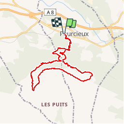

Length
21 km

Max alt
875 m

Uphill gradient
823 m
Km-Effort
32 km

Min alt
367 m

Downhill gradient
828 m
Boucle
Yes
Creation date :
2017-02-08 00:00:00.0
Updated on :
2017-02-08 00:00:00.0
6h28
Difficulty : Medium

FREE GPS app for hiking
 SityTrail
IGN / Geographical institutes
SityTrail Plus
The world is yours!
About
Trail Walking of 21 km to be discovered at Provence-Alpes-Côte d'Azur, Var, Pourcieux. This trail is proposed by Nathy8913.
Positioning
Country:
France
Region :
Provence-Alpes-Côte d'Azur
Department/Province :
Var
Municipality :
Pourcieux
Location:
Unknown
Start:(Dec)
Start:(UTM)
724828 ; 4816639 (31T) N.
Comments