


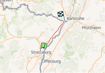
Grand Est - Ligne 33,7 - Strasbourg Lauterbourg

mich54
User

Length
57 km

Max alt
150 m

Uphill gradient
293 m
Km-Effort
61 km

Min alt
105 m

Downhill gradient
330 m
Boucle
No
Creation date :
2017-03-03 00:00:00.0
Updated on :
2017-03-03 00:00:00.0
5m
Difficulty : Unknown

FREE GPS app for hiking
 SityTrail
IGN / Geographical institutes
SityTrail Plus
The world is yours!
About
Trail Other activity of 57 km to be discovered at Grand Est, Bas-Rhin, Strasbourg. This trail is proposed by mich54.
Description
En cours de traitement
(Concept protégé INPI)
Positioning
Country:
France
Region :
Grand Est
Department/Province :
Bas-Rhin
Municipality :
Strasbourg
Location:
Unknown
Start:(Dec)
Start:(UTM)
406639 ; 5382088 (32U) N.
Comments