


Nouveau guide

Valery01
User
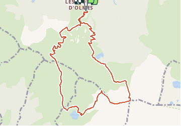

Length
11.4 km

Max alt
2163 m

Uphill gradient
948 m
Km-Effort
24 km

Min alt
1490 m

Downhill gradient
948 m
Boucle
Yes
Creation date :
2014-12-10 00:00:00.0
Updated on :
2014-12-10 00:00:00.0
--
Difficulty : Very difficult

FREE GPS app for hiking
 SityTrail
IGN / Geographical institutes
SityTrail Plus
The world is yours!
About
Trail Walking of 11.4 km to be discovered at Occitania, Ariège, Montferrier. This trail is proposed by Valery01.
Description
pic du han 11km
Positioning
Country:
France
Region :
Occitania
Department/Province :
Ariège
Municipality :
Montferrier
Location:
Unknown
Start:(Dec)
Start:(UTM)
397563 ; 4744122 (31T) N.
Comments