


MLT_01

MichelDubois
User
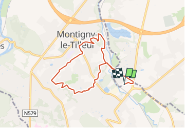

Length
7.6 km

Max alt
187 m

Uphill gradient
145 m
Km-Effort
9.6 km

Min alt
110 m

Downhill gradient
145 m
Boucle
Yes
Creation date :
2017-02-14 00:00:00.0
Updated on :
2017-02-14 00:00:00.0
1h50
Difficulty : Unknown

FREE GPS app for hiking
 SityTrail
IGN / Geographical institutes
SityTrail Plus
The world is yours!
About
Trail Other activity of 7.6 km to be discovered at Wallonia, Hainaut, Charleroi. This trail is proposed by MichelDubois.
Positioning
Country:
Belgium
Region :
Wallonia
Department/Province :
Hainaut
Municipality :
Charleroi
Location:
Mont-sur-Marchienne
Start:(Dec)
Start:(UTM)
599229 ; 5580646 (31U) N.
Comments