


-- plaine de la reynarde - cap mejean - port de la redonne - le maufatan.gpx

georgein
User

Length
21 km

Max alt
234 m

Uphill gradient
546 m
Km-Effort
28 km

Min alt
3 m

Downhill gradient
551 m
Boucle
Yes
Creation date :
2019-08-04 09:23:29.883
Updated on :
2020-01-31 20:34:45.412
--
Difficulty : Unknown

FREE GPS app for hiking
 SityTrail
IGN / Geographical institutes
SityTrail Plus
The world is yours!
About
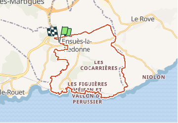
Trail Walking of 21 km to be discovered at Provence-Alpes-Côte d'Azur, Bouches-du-Rhône, Ensuès-la-Redonne. This trail is proposed by georgein.
Positioning
Country:
France
Region :
Provence-Alpes-Côte d'Azur
Department/Province :
Bouches-du-Rhône
Municipality :
Ensuès-la-Redonne
Location:
Unknown
Start:(Dec)
Start:(UTM)
677599 ; 4802787 (31T) N.
Comments