


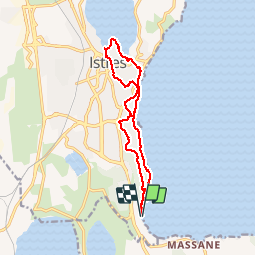
Istres - ville et nature

mhetpierre
User

Length
13.3 km

Max alt
71 m

Uphill gradient
194 m
Km-Effort
15.9 km

Min alt
-1 m

Downhill gradient
194 m
Boucle
Yes
Creation date :
2018-08-18 15:29:54.544
Updated on :
2018-08-18 15:29:54.544
3h34
Difficulty : Very easy

FREE GPS app for hiking
 SityTrail
IGN / Geographical institutes
SityTrail Plus
The world is yours!
About
Trail Walking of 13.3 km to be discovered at Provence-Alpes-Côte d'Azur, Bouches-du-Rhône, Istres. This trail is proposed by mhetpierre.
Positioning
Country:
France
Region :
Provence-Alpes-Côte d'Azur
Department/Province :
Bouches-du-Rhône
Municipality :
Istres
Location:
Unknown
Start:(Dec)
Start:(UTM)
661780 ; 4815567 (31T) N.
Comments
A faire