


chapelle d'Aleyrac - Lancyre

kephas
User
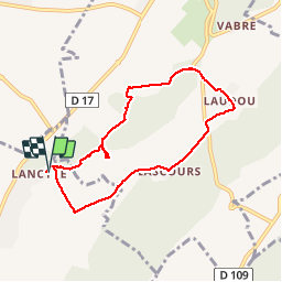

Length
8.1 km

Max alt
169 m

Uphill gradient
106 m
Km-Effort
9.5 km

Min alt
108 m

Downhill gradient
106 m
Boucle
Yes
Creation date :
2017-02-18 00:00:00.0
Updated on :
2017-02-18 00:00:00.0
2h06
Difficulty : Very easy

FREE GPS app for hiking
 SityTrail
IGN / Geographical institutes
SityTrail Plus
The world is yours!
About
Trail Walking of 8.1 km to be discovered at Occitania, Hérault, Valflaunès. This trail is proposed by kephas.
Photos


Positioning
Country:
France
Region :
Occitania
Department/Province :
Hérault
Municipality :
Valflaunès
Location:
Unknown
Start:(Dec)
Start:(UTM)
572076 ; 4851856 (31T) N.
Comments