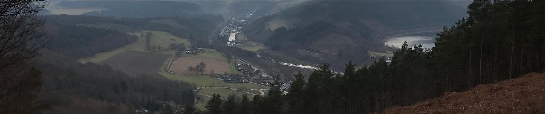
Point de vue de Ster

Pol_Wuidar
User
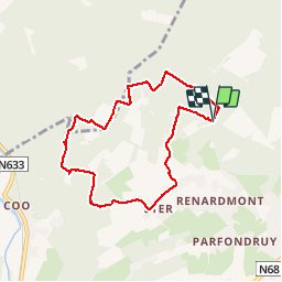

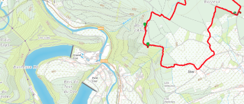
Length
6.7 km

Max alt
510 m

Uphill gradient
111 m
Km-Effort
8.2 km

Min alt
460 m

Downhill gradient
112 m
Boucle
Yes
Creation date :
2017-02-20 00:00:00.0
Updated on :
2017-02-20 00:00:00.0
1h51
Difficulty : Unknown

FREE GPS app for hiking
 SityTrail
IGN / Geographical institutes
SityTrail Plus
The world is yours!
About
Trail Walking of 6.7 km to be discovered at Wallonia, Liège, Stavelot. This trail is proposed by Pol_Wuidar.
Photos


Positioning
Country:
Belgium
Region :
Wallonia
Department/Province :
Liège
Municipality :
Stavelot
Location:
Stavelot
Start:(Dec)
Start:(UTM)
706844 ; 5587278 (31U) N.
Comments