


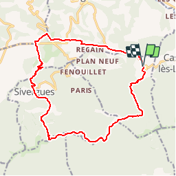
Vaucluse - Auribeau Boucle par Sivergues 19km 601m

RandoVal
User

Length
18.5 km

Max alt
1000 m

Uphill gradient
657 m
Km-Effort
27 km

Min alt
473 m

Downhill gradient
659 m
Boucle
Yes
Creation date :
2018-09-12 19:08:52.911
Updated on :
2018-09-12 19:08:52.924
5h43
Difficulty : Difficult

FREE GPS app for hiking
 SityTrail
IGN / Geographical institutes
SityTrail Plus
The world is yours!
About
Trail Walking of 18.5 km to be discovered at Provence-Alpes-Côte d'Azur, Vaucluse, Auribeau. This trail is proposed by RandoVal.
Description
Boucle en Luberon . sens horaire parking à l'entrée du village.
Les crêtes , les bories.
Positioning
Country:
France
Region :
Provence-Alpes-Côte d'Azur
Department/Province :
Vaucluse
Municipality :
Auribeau
Location:
Unknown
Start:(Dec)
Start:(UTM)
697602 ; 4856765 (31T) N.
Comments