


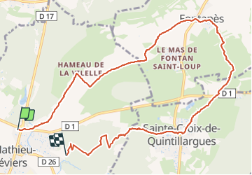
st Mathieu de trevier - fontanes

jeanfcd
User

Length
12.5 km

Max alt
223 m

Uphill gradient
226 m
Km-Effort
15.5 km

Min alt
97 m

Downhill gradient
209 m
Boucle
No
Creation date :
2017-02-26 00:00:00.0
Updated on :
2017-02-26 00:00:00.0
2h12
Difficulty : Unknown

FREE GPS app for hiking
 SityTrail
IGN / Geographical institutes
SityTrail Plus
The world is yours!
About
Trail Other activity of 12.5 km to be discovered at Occitania, Hérault, Saint-Mathieu-de-Tréviers. This trail is proposed by jeanfcd.
Positioning
Country:
France
Region :
Occitania
Department/Province :
Hérault
Municipality :
Saint-Mathieu-de-Tréviers
Location:
Unknown
Start:(Dec)
Start:(UTM)
569930 ; 4847152 (31T) N.
Comments