


Les Arcs- Sommet des Terriers reco

Sugg
User


Length
13 km

Max alt
335 m

Uphill gradient
393 m
Km-Effort
18.2 km

Min alt
28 m

Downhill gradient
387 m
Boucle
Yes
Creation date :
2019-03-22 16:58:48.397
Updated on :
2019-03-22 16:58:48.523
5h02
Difficulty : Medium

FREE GPS app for hiking
 SityTrail
IGN / Geographical institutes
SityTrail Plus
The world is yours!
About
Trail Walking of 13 km to be discovered at Provence-Alpes-Côte d'Azur, Var, Les Arcs-sur-Argens. This trail is proposed by Sugg.
Description
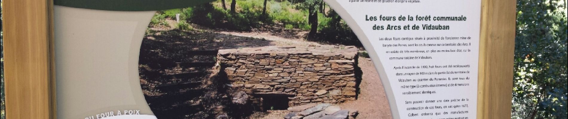
reco partielle sommet des Terriers
Photos


Positioning
Country:
France
Region :
Provence-Alpes-Côte d'Azur
Department/Province :
Var
Municipality :
Les Arcs-sur-Argens
Location:
Unknown
Start:(Dec)
Start:(UTM)
298547 ; 4812169 (32T) N.
Comments