


Bagnols-La Forteresse

Sugg
User

Length
17.6 km

Max alt
419 m

Uphill gradient
529 m
Km-Effort
25 km

Min alt
91 m

Downhill gradient
530 m
Boucle
Yes
Creation date :
2019-03-22 16:58:45.164
Updated on :
2019-03-22 16:58:45.244
5h14
Difficulty : Medium

FREE GPS app for hiking
 SityTrail
IGN / Geographical institutes
SityTrail Plus
The world is yours!
About
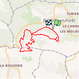
Trail Walking of 17.6 km to be discovered at Provence-Alpes-Côte d'Azur, Var, Bagnols-en-Forêt. This trail is proposed by Sugg.
Description
Rando RF
Positioning
Country:
France
Region :
Provence-Alpes-Côte d'Azur
Department/Province :
Var
Municipality :
Bagnols-en-Forêt
Location:
Unknown
Start:(Dec)
Start:(UTM)
313448 ; 4822265 (32T) N.
Comments
très belle randonnée avec un côté historique et de très beaux paysages
bien