


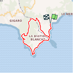
L'Escalet- Cap Lardier rando

Sugg
User

Length
16.7 km

Max alt
163 m

Uphill gradient
442 m
Km-Effort
23 km

Min alt
0 m

Downhill gradient
443 m
Boucle
Yes
Creation date :
2019-03-22 16:58:41.933
Updated on :
2019-03-22 16:58:42.012
4h52
Difficulty : Easy

FREE GPS app for hiking
 SityTrail
IGN / Geographical institutes
SityTrail Plus
The world is yours!
About
Trail Walking of 16.7 km to be discovered at Provence-Alpes-Côte d'Azur, Var, Ramatuelle. This trail is proposed by Sugg.
Description
27 mai 2015.Rando RF, guide : Pierre, super journée.
Positioning
Country:
France
Region :
Provence-Alpes-Côte d'Azur
Department/Province :
Var
Municipality :
Ramatuelle
Location:
Unknown
Start:(Dec)
Start:(UTM)
308346 ; 4784357 (32T) N.
Comments