


LES MENHIRS DU THOUREIL

laoj
User

Length
7.4 km

Max alt
87 m

Uphill gradient
131 m
Km-Effort
9.1 km

Min alt
27 m

Downhill gradient
126 m
Boucle
Yes
Creation date :
2017-02-28 00:00:00.0
Updated on :
2017-02-28 00:00:00.0
1h59
Difficulty : Easy

FREE GPS app for hiking
 SityTrail
IGN / Geographical institutes
SityTrail Plus
The world is yours!
About
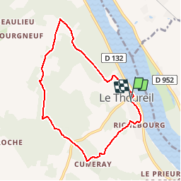
Trail Walking of 7.4 km to be discovered at Pays de la Loire, Maine-et-Loire, Gennes-Val-de-Loire. This trail is proposed by laoj.
Description
DÉPART ET ARRIVEE PARKING ATELIERS MUNICIPAUX
PASSAGE À PROXIMITÉ DES MENHIRS DE LA BUTTE AUX HOUX ET DE LA PIERRE DE NÉZAN !
Positioning
Country:
France
Region :
Pays de la Loire
Department/Province :
Maine-et-Loire
Municipality :
Gennes-Val-de-Loire
Location:
Unknown
Start:(Dec)
Start:(UTM)
706390 ; 5249979 (30T) N.
Comments