


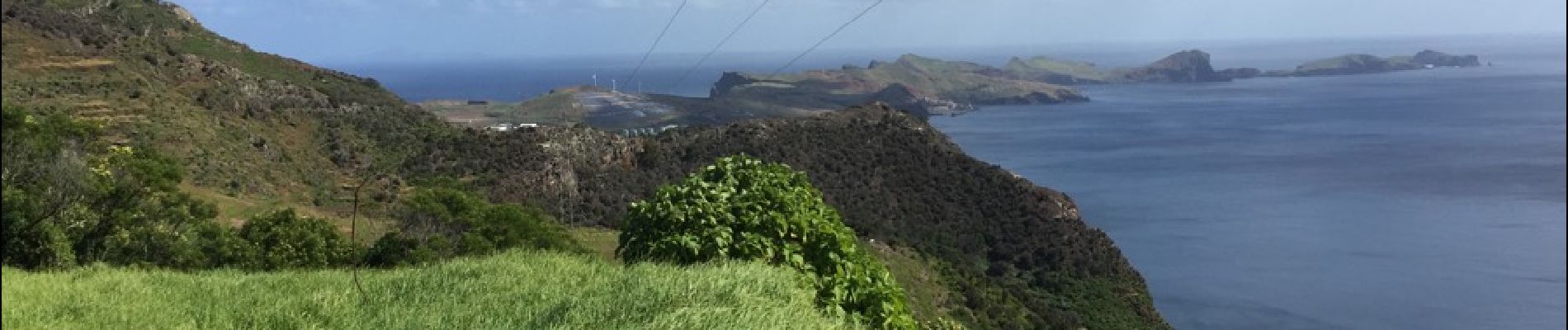
trajet de machico à canical

nicolasdresse
User
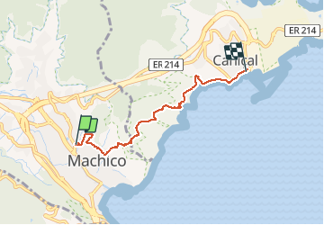

Length
5.6 km

Max alt
286 m

Uphill gradient
291 m
Km-Effort
9.6 km

Min alt
4 m

Downhill gradient
319 m
Boucle
No
Creation date :
2018-09-29 20:52:24.017
Updated on :
2018-09-29 20:52:24.098
2h33
Difficulty : Medium

FREE GPS app for hiking
 SityTrail
IGN / Geographical institutes
SityTrail Plus
The world is yours!
About
Trail Other activity of 5.6 km to be discovered at Madeira, Unknown, Machico. This trail is proposed by nicolasdresse.
Photos


Positioning
Country:
Portugal
Region :
Madeira
Department/Province :
Unknown
Municipality :
Machico
Location:
Unknown
Start:(Dec)
Start:(UTM)
334148 ; 3622242 (28S) N.
Comments
Merci pour ce partage.