


autour de st aygulf

bernir
User

Length
12.4 km

Max alt
132 m

Uphill gradient
215 m
Km-Effort
15.3 km

Min alt
0 m

Downhill gradient
211 m
Boucle
Yes
Creation date :
2017-03-03 00:00:00.0
Updated on :
2017-03-03 00:00:00.0
7h04
Difficulty : Easy

FREE GPS app for hiking
 SityTrail
IGN / Geographical institutes
SityTrail Plus
The world is yours!
About
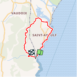
Trail Walking of 12.4 km to be discovered at Provence-Alpes-Côte d'Azur, Var, Roquebrune-sur-Argens. This trail is proposed by bernir.
Positioning
Country:
France
Region :
Provence-Alpes-Côte d'Azur
Department/Province :
Var
Municipality :
Roquebrune-sur-Argens
Location:
Unknown
Start:(Dec)
Start:(UTM)
314690 ; 4803999 (32T) N.
Comments