


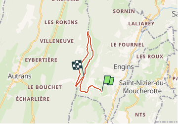
Vercors Charande par le pas de bellecombe

flux99
User

Length
9 km

Max alt
1716 m

Uphill gradient
582 m
Km-Effort
15.6 km

Min alt
1236 m

Downhill gradient
233 m
Boucle
No
Creation date :
2014-12-10 00:00:00.0
Updated on :
2014-12-10 00:00:00.0
--
Difficulty : Medium

FREE GPS app for hiking
 SityTrail
IGN / Geographical institutes
SityTrail Plus
The world is yours!
About
Trail Walking of 9 km to be discovered at Auvergne-Rhône-Alpes, Isère, Engins. This trail is proposed by flux99.
Description
Accès D531 l'Olette dir Le Mas ,Les aigaux.départ Les Mercier
Positioning
Country:
France
Region :
Auvergne-Rhône-Alpes
Department/Province :
Isère
Municipality :
Engins
Location:
Unknown
Start:(Dec)
Start:(UTM)
704425 ; 5004965 (31T) N.
Comments