


Vallée de Charsac

ajd26
User
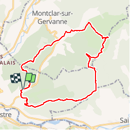

Length
19 km

Max alt
660 m

Uphill gradient
601 m
Km-Effort
27 km

Min alt
254 m

Downhill gradient
606 m
Boucle
Yes
Creation date :
2019-05-19 18:03:49.152
Updated on :
2019-05-19 18:03:50.25
4h37
Difficulty : Easy

FREE GPS app for hiking
 SityTrail
IGN / Geographical institutes
SityTrail Plus
The world is yours!
About
Trail Walking of 19 km to be discovered at Auvergne-Rhône-Alpes, Drôme, Mirabel-et-Blacons. This trail is proposed by ajd26.
Description
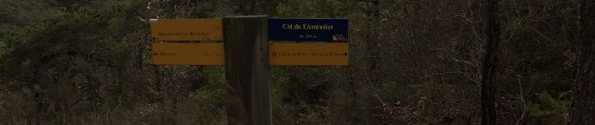
Départ après Crest, direction Die, prendre route à gauche juste après le pont qui traverse la Drôme
Photos


Positioning
Country:
France
Region :
Auvergne-Rhône-Alpes
Department/Province :
Drôme
Municipality :
Mirabel-et-Blacons
Location:
Unknown
Start:(Dec)
Start:(UTM)
668261 ; 4953202 (31T) N.
Comments