


Descente vers La Bourboule

Bobol
User

Length
13 km

Max alt
1250 m

Uphill gradient
629 m
Km-Effort
21 km

Min alt
855 m

Downhill gradient
629 m
Boucle
Yes
Creation date :
2014-12-10 00:00:00.0
Updated on :
2014-12-10 00:00:00.0
4h00
Difficulty : Medium

FREE GPS app for hiking
 SityTrail
IGN / Geographical institutes
SityTrail Plus
The world is yours!
About
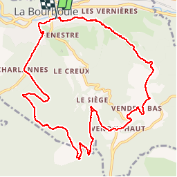
Trail Walking of 13 km to be discovered at Auvergne-Rhône-Alpes, Puy-de-Dôme, La Bourboule. This trail is proposed by Bobol.
Description
Après avoir pris le téléphérique, retour vers la Bouboule
Positioning
Country:
France
Region :
Auvergne-Rhône-Alpes
Department/Province :
Puy-de-Dôme
Municipality :
La Bourboule
Location:
Unknown
Start:(Dec)
Start:(UTM)
479934 ; 5048299 (31T) N.
Comments