


Puimoisson 04

mhetpierre
User
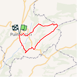

Length
11.4 km

Max alt
775 m

Uphill gradient
285 m
Km-Effort
15.2 km

Min alt
602 m

Downhill gradient
285 m
Boucle
Yes
Creation date :
2018-08-18 15:29:53.783
Updated on :
2018-08-18 15:29:53.783
3h20
Difficulty : Easy

FREE GPS app for hiking
 SityTrail
IGN / Geographical institutes
SityTrail Plus
The world is yours!
About
Trail Walking of 11.4 km to be discovered at Provence-Alpes-Côte d'Azur, Alpes-de-Haute-Provence, Puimoisson. This trail is proposed by mhetpierre.
Description
facile
Positioning
Country:
France
Region :
Provence-Alpes-Côte d'Azur
Department/Province :
Alpes-de-Haute-Provence
Municipality :
Puimoisson
Location:
Unknown
Start:(Dec)
Start:(UTM)
269131 ; 4860674 (32T) N.
Comments