


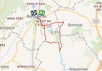
Ronquières_Warchais_Vx Canal

denissculier
User

Length
10.1 km

Max alt
111 m

Uphill gradient
126 m
Km-Effort
11.8 km

Min alt
58 m

Downhill gradient
127 m
Boucle
Yes
Creation date :
2017-03-14 00:00:00.0
Updated on :
2017-03-14 00:00:00.0
2h35
Difficulty : Medium

FREE GPS app for hiking
 SityTrail
IGN / Geographical institutes
SityTrail Plus
The world is yours!
About
Trail Nordic walking of 10.1 km to be discovered at Wallonia, Hainaut, Braine-le-Comte. This trail is proposed by denissculier.
Positioning
Country:
Belgium
Region :
Wallonia
Department/Province :
Hainaut
Municipality :
Braine-le-Comte
Location:
Ronquières
Start:(Dec)
Start:(UTM)
586727 ; 5606756 (31U) N.
Comments