


Vers la source de l'Amblève

denissculier
User
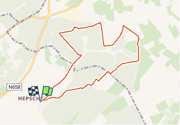

Length
8.6 km

Max alt
620 m

Uphill gradient
186 m
Km-Effort
11.1 km

Min alt
522 m

Downhill gradient
187 m
Boucle
Yes
Creation date :
2018-02-09 00:00:00.0
Updated on :
2020-09-14 16:24:06.244
2h23
Difficulty : Medium

FREE GPS app for hiking
 SityTrail
IGN / Geographical institutes
SityTrail Plus
The world is yours!
About
Trail Walking of 8.6 km to be discovered at Wallonia, Liège, Amel. This trail is proposed by denissculier.
Positioning
Country:
Belgium
Region :
Wallonia
Department/Province :
Liège
Municipality :
Amel
Location:
Heppenbach
Start:(Dec)
Start:(UTM)
302835 ; 5584215 (32U) N.
Comments