


pilon du roi face sud

bernir
User

Length
16.6 km

Max alt
669 m

Uphill gradient
573 m
Km-Effort
24 km

Min alt
186 m

Downhill gradient
576 m
Boucle
Yes
Creation date :
2017-03-17 00:00:00.0
Updated on :
2017-03-17 00:00:00.0
6h52
Difficulty : Difficult

FREE GPS app for hiking
 SityTrail
IGN / Geographical institutes
SityTrail Plus
The world is yours!
About
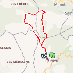
Trail Walking of 16.6 km to be discovered at Provence-Alpes-Côte d'Azur, Bouches-du-Rhône, Allauch. This trail is proposed by bernir.
Description
plan de cuques- pilon-col st anne-grotte- vallon du petit cornillon

Positioning
Country:
France
Region :
Provence-Alpes-Côte d'Azur
Department/Province :
Bouches-du-Rhône
Municipality :
Allauch
Location:
Unknown
Start:(Dec)
Start:(UTM)
701784 ; 4804197 (31T) N.
Comments