


Pégairolles de Buèges - mas Neuf - menhir de Larret

vertygo
User
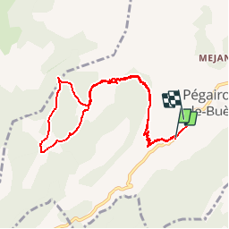

Length
10 km

Max alt
702 m

Uphill gradient
443 m
Km-Effort
16 km

Min alt
252 m

Downhill gradient
472 m
Boucle
No
Creation date :
2017-03-22 00:00:00.0
Updated on :
2017-03-22 00:00:00.0
3h18
Difficulty : Medium

FREE GPS app for hiking
 SityTrail
IGN / Geographical institutes
SityTrail Plus
The world is yours!
About
Trail Walking of 10 km to be discovered at Occitania, Hérault, Pégairolles-de-Buèges. This trail is proposed by vertygo.
Description
voir des photos sur www.vertygo.org
https://goo.gl/photos/BXdu3cGE9GQL67fE9
Positioning
Country:
France
Region :
Occitania
Department/Province :
Hérault
Municipality :
Pégairolles-de-Buèges
Location:
Unknown
Start:(Dec)
Start:(UTM)
546583 ; 4850000 (31T) N.
Comments