Trail Walking Tubize - Coeurcq 0317 - Photo
© OpenStreetMap contributors
Length
Length
6.8 km
Max alt
Max alt
97 m
Uphill gradient
Uphill gradient
86 m
Km-Effort
Km-Effort  
7.9 km
Min alt
Min alt
41 m
Downhill gradient
Downhill gradient
86 m
Boucle
Boucle
Yes
Creation date :
2018-07-07 13:32:52.766
Updated on :
2018-07-07 13:32:52.766

(0 Reviews)

Walking
Walking
1h45
Difficulty : Easy

Scan this QR Code to open this trail in the SityTrail application

FREE GPS app for hiking

Logo SityTrail SityTrail

IGN / Geographical institutes

Download SityTrail from the App Store Download SityTrail from Google Play

Logo SityTrail SityTrail World

The world is yours!

Download SityTrail from the App Store Download SityTrail from Google Play Download SityTrail on Huawei AppGallery

About

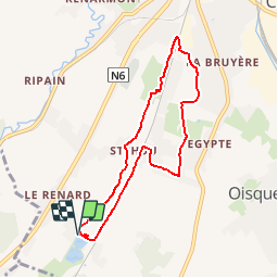
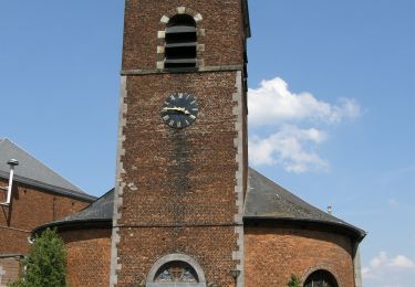
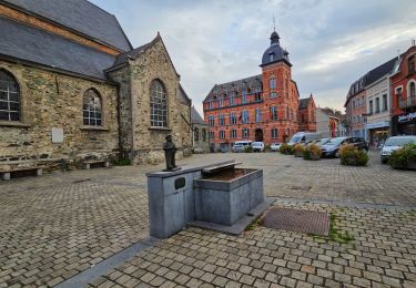
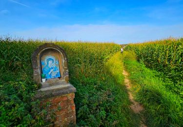
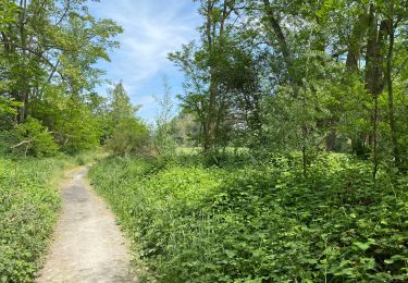
Trail Walking of 6.8 km to be discovered at Wallonia, Walloon Brabant, Tubize. This trail is proposed by calofrancis.

Description

Au départ des étangs de Coeurcq. Cette balade suit le ry de Coeurcq jusqu'au début de sa partie souterraine en dessous de l'agglomération de Tubize.

Le retour via le chemin des crêtes permet de voir un grand panorama sur toute la région ainsi que les plus grands bâtiments de Bruxelles.


___www.marcheursdumardi.be___

Elevation profile

Points of interest

Point of interest Tubize - Etangs de Coeurcq - Photo
calofrancis
Point of interest Tubize - Moulin Fantôme - Photo
calofrancis
Point of interest Tubize - Hameau de Stéhoux - Photo
calofrancis
Point of interest Tubize - Ferme Massart - Photo
calofrancis

Positioning

Country:
Belgium
Region :
Wallonia
Department/Province :
Walloon Brabant
Municipality :
Tubize
Location:
Tubize
Start:(UTM)
583895 ; 5613343 (31U) N.

Trails nearby

Trail Walking Rebecq - RB-BW-15-raccourci 1 - Flânerie entre Senne et Coeurcq - Photo
Walking
PRO

Walking

Easy
(2)
Rebecq, Wallonia, Walloon Brabant, Belgium
13.2 km | 15.9 km-effort
5h 36min
Yes
Trail Walking Rebecq - RB-Bw-15_Rebecq - Photo
Walking
PRO

Walking

Easy
(3)
Rebecq, Wallonia, Walloon Brabant, Belgium
24 km | 29 km-effort
6h 9min
Yes
Trail Walking Ittre - #230717 - Virginal-Samme, Ardennes et Grand Bois, dont 2,5 km du GRP 127 - Photo
Walking
Randos Ouvertes

Walking

Medium
(1)
Ittre, Wallonia, Walloon Brabant, Belgium
5.1 km | 6.4 km-effort
1h 27min
Yes
Trail Walking Ittre - #221031 - Virginal-Samme, Bois des Nonnes, Canal, GRP127 - Photo
Walking
Randos Ouvertes

Walking

Medium
(1)
Ittre, Wallonia, Walloon Brabant, Belgium
8.2 km | 9.9 km-effort
2h 15min
Yes
Trail Walking Braine-le-Comte - GG2-Bw-23_Hennuyères-Nivelles-provisoire_2021-11-07 - Photo
Walking
PRO

Walking

Very difficult
(2)
Braine-le-Comte, Wallonia, Hainaut, Belgium
25 km | 29 km-effort
6h 39min
No
Trail Walking Tubize - Balade à Tubize - Photo
Walking
GUIDE
Desrumaux

Walking

Medium
Tubize, Wallonia, Walloon Brabant, Belgium
8.4 km | 9.7 km-effort
2h 11min
Yes
Trail Walking Braine-le-Comte - Marche Adeps à Hennuyères - Photo
Walking
GUIDE
Desrumaux

Walking

Difficult
(1)
Braine-le-Comte, Wallonia, Hainaut, Belgium
11.4 km | 13.4 km-effort
3h 2min
Yes
Trail Walking Tubize - Oisquercq 15 km test gps  - Photo
Walking
GUIDE
rvapeldo

Walking

Medium
Tubize, Wallonia, Walloon Brabant, Belgium
15.7 km | 19.3 km-effort
3h 35min
Yes
Trail Walking Ittre - Balade à Virginal-Samme - Photo
Walking
GUIDE
Desrumaux

Walking

Medium
(1)
Ittre, Wallonia, Walloon Brabant, Belgium
10.2 km | 12.4 km-effort
2h 41min
Yes


Close
My subscriptions