


Cévennes - Blacherette

soca
User

Length
9.7 km

Max alt
865 m

Uphill gradient
377 m
Km-Effort
14.7 km

Min alt
531 m

Downhill gradient
373 m
Boucle
Yes
Creation date :
2017-03-27 00:00:00.0
Updated on :
2017-03-27 00:00:00.0
3h16
Difficulty : Medium

FREE GPS app for hiking
 SityTrail
IGN / Geographical institutes
SityTrail Plus
The world is yours!
About
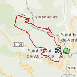
Trail Walking of 9.7 km to be discovered at Occitania, Lozère, Saint-Privat-de-Vallongue. This trail is proposed by soca.
Positioning
Country:
France
Region :
Occitania
Department/Province :
Lozère
Municipality :
Saint-Privat-de-Vallongue
Location:
Unknown
Start:(Dec)
Start:(UTM)
567709 ; 4902987 (31T) N.
Comments