


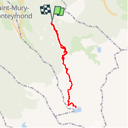
Lac Blanc depuis Pré Marcel via Refuge Jean Collet

McTracy004
User

Length
16.9 km

Max alt
2202 m

Uphill gradient
1227 m
Km-Effort
33 km

Min alt
1301 m

Downhill gradient
1238 m
Boucle
Yes
Creation date :
2014-12-10 00:00:00.0
Updated on :
2014-12-10 00:00:00.0
7h11
Difficulty : Medium

FREE GPS app for hiking
 SityTrail
IGN / Geographical institutes
SityTrail Plus
The world is yours!
About
Trail Walking of 16.9 km to be discovered at Auvergne-Rhône-Alpes, Isère, Sainte-Agnès. This trail is proposed by McTracy004.
Description
Depuis Villard-Bonnot, suivre la direction Saint Agnès puis Col des Mouilles. Au col prendre la direction Pré Marcel - Refuge Jean Collet. De là suivre le GR en direction du refuge
Positioning
Country:
France
Region :
Auvergne-Rhône-Alpes
Department/Province :
Isère
Municipality :
Sainte-Agnès
Location:
Unknown
Start:(Dec)
Start:(UTM)
732006 ; 5011789 (31T) N.
Comments