


Violay (42780)

Thomasdanielle
User

Length
18.9 km

Max alt
898 m

Uphill gradient
535 m
Km-Effort
26 km

Min alt
619 m

Downhill gradient
539 m
Boucle
Yes
Creation date :
2017-04-04 00:00:00.0
Updated on :
2017-04-04 00:00:00.0
5h29
Difficulty : Easy

FREE GPS app for hiking
 SityTrail
IGN / Geographical institutes
SityTrail Plus
The world is yours!
About
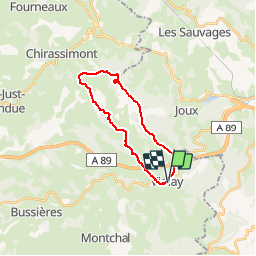
Trail Walking of 18.9 km to be discovered at Auvergne-Rhône-Alpes, Loire, Violay. This trail is proposed by Thomasdanielle.
Description
Départ Parking en face Mairie de Violay
03/04/2017
Belle randonnée pédestre, sans grande difficulté, souvent emprunté par les VTT (circuit A3)
Positioning
Country:
France
Region :
Auvergne-Rhône-Alpes
Department/Province :
Loire
Municipality :
Violay
Location:
Unknown
Start:(Dec)
Start:(UTM)
605398 ; 5078531 (31T) N.
Comments