


Les crêtes du Rayol

soca
User

Length
13.6 km

Max alt
424 m

Uphill gradient
630 m
Km-Effort
22 km

Min alt
12 m

Downhill gradient
635 m
Boucle
No
Creation date :
2017-04-02 00:00:00.0
Updated on :
2017-04-02 00:00:00.0
5h20
Difficulty : Medium

FREE GPS app for hiking
 SityTrail
IGN / Geographical institutes
SityTrail Plus
The world is yours!
About
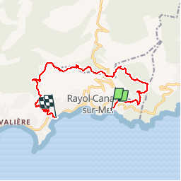
Trail Walking of 13.6 km to be discovered at Provence-Alpes-Côte d'Azur, Var, Rayol-Canadel-sur-Mer. This trail is proposed by soca.
Positioning
Country:
France
Region :
Provence-Alpes-Côte d'Azur
Department/Province :
Var
Municipality :
Rayol-Canadel-sur-Mer
Location:
Unknown
Start:(Dec)
Start:(UTM)
294863 ; 4781300 (32T) N.
Comments