


balade Argentré

Axelloceane
User

Length
4.3 km

Max alt
109 m

Uphill gradient
54 m
Km-Effort
5 km

Min alt
60 m

Downhill gradient
54 m
Boucle
Yes
Creation date :
2018-02-07 00:00:00.0
Updated on :
2018-02-07 00:00:00.0
59m
Difficulty : Easy

FREE GPS app for hiking
 SityTrail
IGN / Geographical institutes
SityTrail Plus
The world is yours!
About
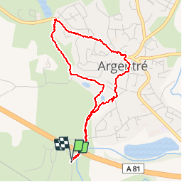
Trail Walking of 4.3 km to be discovered at Pays de la Loire, Mayenne, Argentré. This trail is proposed by Axelloceane.
Positioning
Country:
France
Region :
Pays de la Loire
Department/Province :
Mayenne
Municipality :
Argentré
Location:
Unknown
Start:(Dec)
Start:(UTM)
675159 ; 5327395 (30U) N.
Comments