


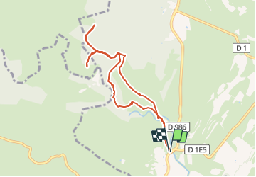
2017-02 Ravin des Arcs - Roc Rouge - Bois de la Garde

vertygo
User

Length
8.7 km

Max alt
302 m

Uphill gradient
346 m
Km-Effort
13.3 km

Min alt
146 m

Downhill gradient
344 m
Boucle
Yes
Creation date :
2017-05-29 00:00:00.0
Updated on :
2017-05-29 00:00:00.0
3h27
Difficulty : Medium

FREE GPS app for hiking
 SityTrail
IGN / Geographical institutes
SityTrail Plus
The world is yours!
About
Trail Walking of 8.7 km to be discovered at Occitania, Hérault, Notre-Dame-de-Londres. This trail is proposed by vertygo.
Description
cliquer pour <a href=https://goo.gl/photos/iWYN9Wo1ieohPWm98 target=_blank>voir des photos</a> - d'autres parcours sur <a href='http://www.vertygo.org' target=_blank> www.vertygo.org</a>
Positioning
Country:
France
Region :
Occitania
Department/Province :
Hérault
Municipality :
Notre-Dame-de-Londres
Location:
Unknown
Start:(Dec)
Start:(UTM)
559677 ; 4851256 (31T) N.
Comments