


Vadencourt_2

JJDOLLE
User
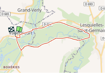

Length
7.5 km

Max alt
116 m

Uphill gradient
61 m
Km-Effort
8.3 km

Min alt
85 m

Downhill gradient
62 m
Boucle
Yes
Creation date :
2018-10-15 15:11:10.078
Updated on :
2021-05-15 12:28:28.584
1h40
Difficulty : Unknown

FREE GPS app for hiking
 SityTrail
IGN / Geographical institutes
SityTrail Plus
The world is yours!
About
Trail Other activity of 7.5 km to be discovered at Hauts-de-France, Aisne, Vadencourt. This trail is proposed by JJDOLLE.
Positioning
Country:
France
Region :
Hauts-de-France
Department/Province :
Aisne
Municipality :
Vadencourt
Location:
Unknown
Start:(Dec)
Start:(UTM)
541396 ; 5530871 (31U) N.
Comments