


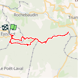
ezahut tournellefuret

Joel26400
User

Length
17.1 km

Max alt
966 m

Uphill gradient
937 m
Km-Effort
30 km

Min alt
501 m

Downhill gradient
933 m
Boucle
Yes
Creation date :
2017-04-20 00:00:00.0
Updated on :
2017-04-20 00:00:00.0
6h39
Difficulty : Medium

FREE GPS app for hiking
 SityTrail
IGN / Geographical institutes
SityTrail Plus
The world is yours!
About
Trail Walking of 17.1 km to be discovered at Auvergne-Rhône-Alpes, Drôme, Eyzahut. This trail is proposed by Joel26400.
Positioning
Country:
France
Region :
Auvergne-Rhône-Alpes
Department/Province :
Drôme
Municipality :
Eyzahut
Location:
Unknown
Start:(Dec)
Start:(UTM)
659852 ; 4936549 (31T) N.
Comments