


Camp montplaisir vers piton cabris

Fdum
User
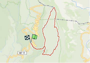

Length
5.7 km

Max alt
1498 m

Uphill gradient
339 m
Km-Effort
10.3 km

Min alt
1194 m

Downhill gradient
343 m
Boucle
Yes
Creation date :
2017-04-25 00:00:00.0
Updated on :
2017-04-25 00:00:00.0
2h05
Difficulty : Medium

FREE GPS app for hiking
 SityTrail
IGN / Geographical institutes
SityTrail Plus
The world is yours!
About
Trail Walking of 5.7 km to be discovered at Réunion, Unknown, Saint-Louis. This trail is proposed by Fdum.
Description
Belle promenade vers la vue sur le cirque de CILAOS, un peu moins de route pour cette vue panoramique. Boucle et descente dans la forêt de cryptoméria.
Positioning
Country:
France
Region :
Réunion
Department/Province :
Unknown
Municipality :
Saint-Louis
Location:
Unknown
Start:(Dec)
Start:(UTM)
336936 ; 7655202 (40K) S.
Comments