


Jozerand_Puy_Murat_Tour

jagarnier
User GUIDE
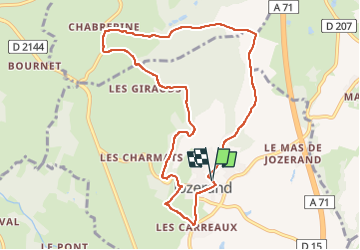

Length
9.5 km

Max alt
554 m

Uphill gradient
203 m
Km-Effort
12.2 km

Min alt
394 m

Downhill gradient
206 m
Boucle
Yes
Creation date :
2017-04-26 00:00:00.0
Updated on :
2025-06-23 13:59:24.478
2h46
Difficulty : Difficult

FREE GPS app for hiking
 SityTrail
IGN / Geographical institutes
SityTrail Plus
The world is yours!
About
Trail Walking of 9.5 km to be discovered at Auvergne-Rhône-Alpes, Puy-de-Dôme, Jozerand. This trail is proposed by jagarnier.
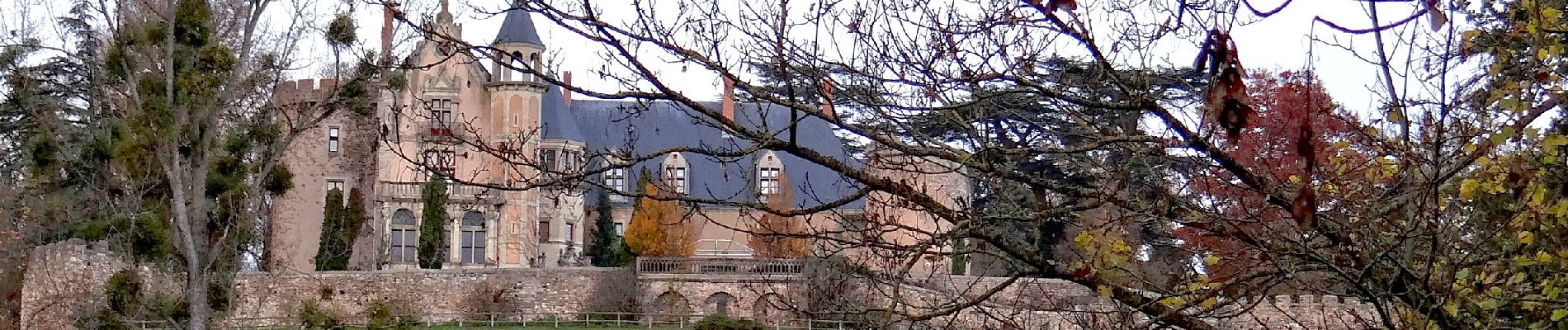
Photos

Positioning
Country:
France
Region :
Auvergne-Rhône-Alpes
Department/Province :
Puy-de-Dôme
Municipality :
Jozerand
Location:
Unknown
Start:(Dec)
Start:(UTM)
507745 ; 5096982 (31T) N.
Comments