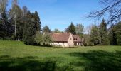
Randonnée autour d'Ottrott

VacheKiri67
User

Length
13.8 km

Max alt
487 m

Uphill gradient
337 m

Km-Effort
18.3 km

Min alt
221 m

Downhill gradient
338 m
Boucle
Yes
Creation date :
2017-04-28 00:00:00.0
Updated on :
2017-04-28 00:00:00.0
5h08
Difficulty : Medium

FREE GPS app for hiking
About
Trail Walking of 13.8 km to be discovered at Grand Est, Bas-Rhin, Ottrott. This trail is proposed by VacheKiri67.
Description
Faite le 23/04/2017 avec notre fils Théo de 12 ans et nos amis Patrice et Monique. D'après "Passion Vosges - Autour du Mont Sainte-Odile" N°14 : Randonnée autour d'Ottrott. Mais avec un aller-retour aux châteaux d'Ottrott (pas d'accès) et un petit tour à la chapelle Saint-Nicolas. Durée indiquée pour le circuit : 3h.
Positioning
Country:
France
Region :
Grand Est
Department/Province :
Bas-Rhin
Municipality :
Ottrott
Location:
Unknown
Start:(Dec)
Start:(UTM)
384217 ; 5368692 (32U) N.
Comments


 SityTrail


Randonnée facile mais sans grande curiosité.