


Col du logis Lac l'Avallan L'Esguine Malpey L'Escarpe

GrouGary
User

Length
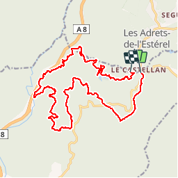
22 km

Max alt
385 m

Uphill gradient
578 m
Km-Effort
30 km

Min alt
39 m

Downhill gradient
563 m
Boucle
No
Creation date :
2017-05-01 00:00:00.0
Updated on :
2017-05-01 00:00:00.0
1h58
Difficulty : Medium

FREE GPS app for hiking
 SityTrail
IGN / Geographical institutes
SityTrail Plus
The world is yours!
About
Trail Mountain bike of 22 km to be discovered at Provence-Alpes-Côte d'Azur, Var, Fréjus. This trail is proposed by GrouGary.
Description
circuit bleu VTT sur pistes bien roulantes, vallonnées de façon équilibrée.
Positioning
Country:
France
Region :
Provence-Alpes-Côte d'Azur
Department/Province :
Var
Municipality :
Fréjus
Location:
Unknown
Start:(Dec)
Start:(UTM)
322718 ; 4820163 (32T) N.
Comments