


2016 Trail nocturne d'écuillé

Remi44184532
User

Length
18.2 km

Max alt
78 m

Uphill gradient
205 m
Km-Effort
21 km

Min alt
26 m

Downhill gradient
206 m
Boucle
Yes
Creation date :
2017-05-03 00:00:00.0
Updated on :
2017-05-03 00:00:00.0
2h03
Difficulty : Medium

FREE GPS app for hiking
 SityTrail
IGN / Geographical institutes
SityTrail Plus
The world is yours!
About
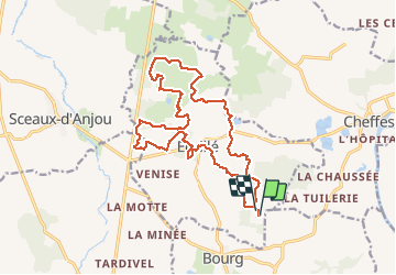
Trail Running of 18.2 km to be discovered at Pays de la Loire, Maine-et-Loire, Écuillé. This trail is proposed by Remi44184532.
Description
2016 12 10 nocturne Ecuillé
Positioning
Country:
France
Region :
Pays de la Loire
Department/Province :
Maine-et-Loire
Municipality :
Écuillé
Location:
Unknown
Start:(Dec)
Start:(UTM)
684593 ; 5274870 (30T) N.
Comments