


Cap Camarat

Derrendinger
User

Length
7.7 km

Max alt
132 m

Uphill gradient
222 m
Km-Effort
10.6 km

Min alt
3 m

Downhill gradient
227 m
Boucle
Yes
Creation date :
2017-05-07 00:00:00.0
Updated on :
2017-05-07 00:00:00.0
2h20
Difficulty : Medium

FREE GPS app for hiking
 SityTrail
IGN / Geographical institutes
SityTrail Plus
The world is yours!
About
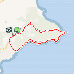
Trail Walking of 7.7 km to be discovered at Provence-Alpes-Côte d'Azur, Var, Ramatuelle. This trail is proposed by Derrendinger.
Description
belle randonné le long de la cote
Positioning
Country:
France
Region :
Provence-Alpes-Côte d'Azur
Department/Province :
Var
Municipality :
Ramatuelle
Location:
Unknown
Start:(Dec)
Start:(UTM)
309062 ; 4785537 (32T) N.
Comments
itinéraire très jolie et bien vu le petit sentier qui descend sur le littoral vers l'escalet au milieu des propriétés privées