


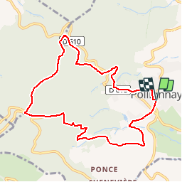
69 POLLIONNAY Croix du Ban

trietsch
User

Length
9.3 km

Max alt
734 m

Uphill gradient
341 m
Km-Effort
13.9 km

Min alt
407 m

Downhill gradient
344 m
Boucle
Yes
Creation date :
2017-05-08 00:00:00.0
Updated on :
2020-01-04 20:29:08.257
2h59
Difficulty : Easy

FREE GPS app for hiking
 SityTrail
IGN / Geographical institutes
SityTrail Plus
The world is yours!
About
Trail Walking of 9.3 km to be discovered at Auvergne-Rhône-Alpes, Rhône, Pollionnay. This trail is proposed by trietsch.
Description
Croix du Ban et Col de la Luère
Positioning
Country:
France
Region :
Auvergne-Rhône-Alpes
Department/Province :
Rhône
Municipality :
Pollionnay
Location:
Unknown
Start:(Dec)
Start:(UTM)
629134 ; 5069277 (31T) N.
Comments