


Rumelange 10.9 306 3h15

vogel.raymond
User
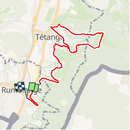

Length
10.9 km

Max alt
390 m

Uphill gradient
250 m
Km-Effort
14.2 km

Min alt
293 m

Downhill gradient
252 m
Boucle
Yes
Creation date :
2017-05-14 00:00:00.0
Updated on :
2019-09-05 21:04:09.86
3h09
Difficulty : Easy

FREE GPS app for hiking
 SityTrail
IGN / Geographical institutes
SityTrail Plus
The world is yours!
About
Trail Walking of 10.9 km to be discovered at Unknown, Canton Esch-sur-Alzette, Rumelange. This trail is proposed by vogel.raymond.
Description
Fond de mines au Luxembourg Rumelange Tétange Dudelange
Positioning
Country:
Luxembourg
Region :
Unknown
Department/Province :
Canton Esch-sur-Alzette
Municipality :
Rumelange
Location:
Unknown
Start:(Dec)
Start:(UTM)
284971 ; 5482738 (32U) N.
Comments