


2017-05-25 Condé sur Vire

Lucquiaud
User
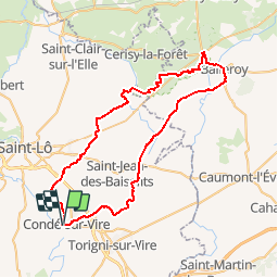

Length
60 km

Max alt
182 m

Uphill gradient
903 m
Km-Effort
72 km

Min alt
23 m

Downhill gradient
904 m
Boucle
Yes
Creation date :
2018-09-15 15:04:00.802
Updated on :
2018-09-15 15:04:02.422
4h37
Difficulty : Medium

FREE GPS app for hiking
 SityTrail
IGN / Geographical institutes
SityTrail Plus
The world is yours!
About
Trail Mountain bike of 60 km to be discovered at Normandy, Manche, Condé-sur-Vire. This trail is proposed by Lucquiaud.
Positioning
Country:
France
Region :
Normandy
Department/Province :
Manche
Municipality :
Condé-sur-Vire
Location:
Condé-sur-Vire
Start:(Dec)
Start:(UTM)
643091 ; 5435009 (30U) N.
Comments