


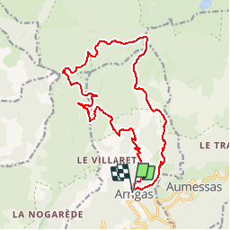
Massif de l'Aigoual - Arrigas - col des airettes - rocher de Saint-Guiral - col de l'Homme mort

vertygo
User

Length
19.3 km

Max alt
1340 m

Uphill gradient
923 m
Km-Effort
32 km

Min alt
502 m

Downhill gradient
925 m
Boucle
Yes
Creation date :
2017-05-29 00:00:00.0
Updated on :
2017-05-29 00:00:00.0
6h34
Difficulty : Difficult

FREE GPS app for hiking
 SityTrail
IGN / Geographical institutes
SityTrail Plus
The world is yours!
About
Trail Walking of 19.3 km to be discovered at Occitania, Gard, Arrigas. This trail is proposed by vertygo.
Description
cliquer pour <a href=https://goo.gl/photos/zUo1Cevvf2MwqqVr7 target=_blank>voir des photos</a> - d'autres parcours sur <a href='http://www.vertygo.org' target=_blank> www.vertygo.org</a>
Positioning
Country:
France
Region :
Occitania
Department/Province :
Gard
Municipality :
Arrigas
Location:
Unknown
Start:(Dec)
Start:(UTM)
538486 ; 4870839 (31T) N.
Comments