


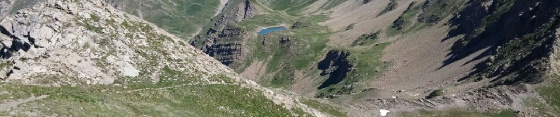
Mont Guillaume.Col de Chanteperdrix 07 07 16.

Dervalmarc
User
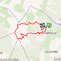

Length
15.4 km

Max alt
2625 m

Uphill gradient
1149 m
Km-Effort
31 km

Min alt
1597 m

Downhill gradient
1142 m
Boucle
Yes
Creation date :
2017-05-28 00:00:00.0
Updated on :
2017-05-28 00:00:00.0
6h11
Difficulty : Difficult

FREE GPS app for hiking
 SityTrail
IGN / Geographical institutes
SityTrail Plus
The world is yours!
About
Trail Walking of 15.4 km to be discovered at Provence-Alpes-Côte d'Azur, Hautes-Alpes, Embrun. This trail is proposed by Dervalmarc.
Description
Randonnée très aérienne a partir du col de Trempa Latz.la Descente très raide au lac de l'Hivernet est particulièrement raide.
Photos


Positioning
Country:
France
Region :
Provence-Alpes-Côte d'Azur
Department/Province :
Hautes-Alpes
Municipality :
Embrun
Location:
Unknown
Start:(Dec)
Start:(UTM)
299622 ; 4940912 (32T) N.
Comments