


gordes 30 sept 2015

fernandezyvan
User
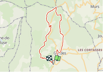

Length
17.7 km

Max alt
595 m

Uphill gradient
451 m
Km-Effort
24 km

Min alt
259 m

Downhill gradient
451 m
Boucle
Yes
Creation date :
2017-09-15 00:00:00.0
Updated on :
2017-09-15 00:00:00.0
5h04
Difficulty : Very difficult

FREE GPS app for hiking
 SityTrail
IGN / Geographical institutes
SityTrail Plus
The world is yours!
About
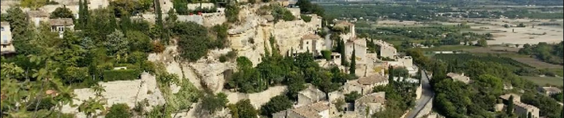
Trail Walking of 17.7 km to be discovered at Provence-Alpes-Côte d'Azur, Vaucluse, Gordes. This trail is proposed by fernandezyvan.
Description
Départ parking avant le croisement de la D2 et D15. Village des bories, Sénanque. Col des 3 termes puis visite Gordes. Très jolie randonnée
Photos


Positioning
Country:
France
Region :
Provence-Alpes-Côte d'Azur
Department/Province :
Vaucluse
Municipality :
Gordes
Location:
Unknown
Start:(Dec)
Start:(UTM)
676081 ; 4863229 (31T) N.
Comments