


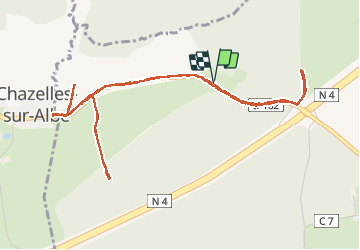
Grandseille Chazelles

reneperrin
User

Length
5.5 km

Max alt
308 m

Uphill gradient
91 m
Km-Effort
6.7 km

Min alt
246 m

Downhill gradient
92 m
Boucle
Yes
Creation date :
2017-05-31 00:00:00.0
Updated on :
2017-05-31 00:00:00.0
1h20
Difficulty : Very easy

FREE GPS app for hiking
 SityTrail
IGN / Geographical institutes
SityTrail Plus
The world is yours!
About
Trail Walking of 5.5 km to be discovered at Grand Est, Meurthe-et-Moselle, Verdenal. This trail is proposed by reneperrin.
Positioning
Country:
France
Region :
Grand Est
Department/Province :
Meurthe-et-Moselle
Municipality :
Verdenal
Location:
Unknown
Start:(Dec)
Start:(UTM)
337393 ; 5384395 (32U) N.
Comments