


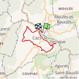
Ganges-Cazilhac

philcll
User

Length
11.7 km

Max alt
416 m

Uphill gradient
384 m
Km-Effort
16.8 km

Min alt
139 m

Downhill gradient
385 m
Boucle
Yes
Creation date :
2017-06-08 00:00:00.0
Updated on :
2017-06-08 00:00:00.0
3h36
Difficulty : Medium

FREE GPS app for hiking
 SityTrail
IGN / Geographical institutes
SityTrail Plus
The world is yours!
About
Trail Walking of 11.7 km to be discovered at Occitania, Hérault, Ganges. This trail is proposed by philcll.
Positioning
Country:
France
Region :
Occitania
Department/Province :
Hérault
Municipality :
Ganges
Location:
Unknown
Start:(Dec)
Start:(UTM)
556727 ; 4864274 (31T) N.
Comments