


Tour et Collet de Burenta

GrouGary
User

Length
14.4 km

Max alt
1973 m

Uphill gradient
1001 m
Km-Effort
28 km

Min alt
1015 m

Downhill gradient
943 m
Boucle
No
Creation date :
2017-06-10 00:00:00.0
Updated on :
2017-06-10 00:00:00.0
5h46
Difficulty : Medium

FREE GPS app for hiking
 SityTrail
IGN / Geographical institutes
SityTrail Plus
The world is yours!
About
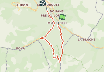
Trail Walking of 14.4 km to be discovered at Provence-Alpes-Côte d'Azur, Maritime Alps, Saint-Étienne-de-Tinée. This trail is proposed by GrouGary.
Description
Montée et descente dans 2 vallons ombragés. Au pied de la face Nord du Mt Mounier.
Prévoir 2 voitures pour éviter la route retour.
Positioning
Country:
France
Region :
Provence-Alpes-Côte d'Azur
Department/Province :
Maritime Alps
Municipality :
Saint-Étienne-de-Tinée
Location:
Unknown
Start:(Dec)
Start:(UTM)
338154 ; 4897259 (32T) N.
Comments