


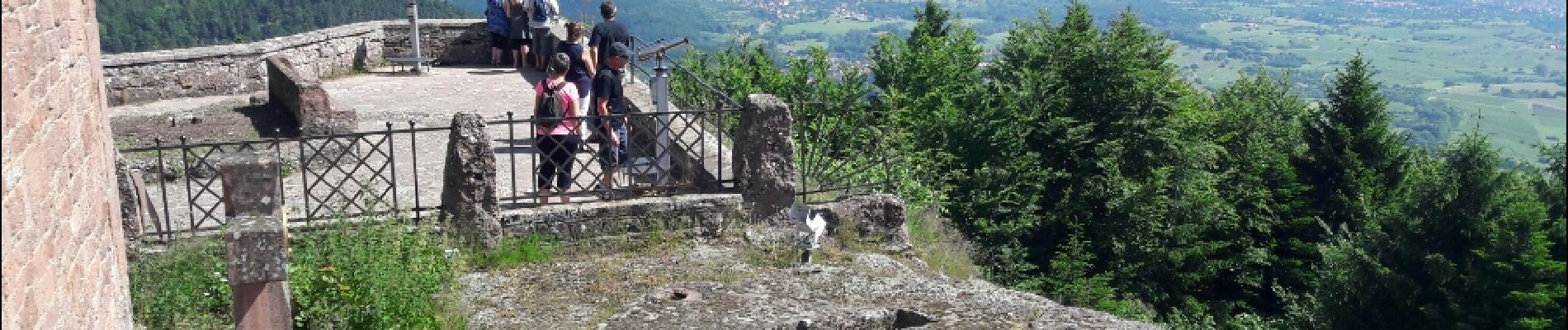
Le circuit nord du Mur Païen

VacheKiri67
User


2h04
Difficulty : Easy

FREE GPS app for hiking
 SityTrail
IGN / Geographical institutes
SityTrail Plus
The world is yours!
About
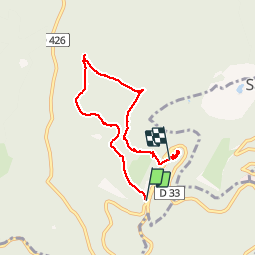
Trail Walking of 5.9 km to be discovered at Grand Est, Bas-Rhin, Ottrott. This trail is proposed by VacheKiri67.
Description
Faite le 11/06/2017 avec notre fils Théo de 12 ans. D'après "Passion Vosges - Autour du Mont Sainte-Odile" N°02 Le circuit nord du Mur Païen. Durée indiquée pour le circuit : 2 heures 30.
Balisage : chevalet jaune.
Le tracé n'est pas bouclé car ce circuit a été enchaîné avec "Le circuit sud du Mur Païen".
Photos


25 photos in total. Please click on a photo to see them all in the gallery.
Positioning
Comments
Mur Paien et Sainte-Odile, un lieu mag(n)i(fi)que !