


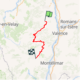
2017-06-15 Ardéchoise Saint Félicien - Lussas

Lucquiaud
User

Length
138 km

Max alt
1022 m

Uphill gradient
2801 m
Km-Effort
176 km

Min alt
178 m

Downhill gradient
3040 m
Boucle
No
Creation date :
2018-09-15 15:03:35.236
Updated on :
2018-09-15 15:03:36.02
8h00
Difficulty : Difficult

FREE GPS app for hiking
 SityTrail
IGN / Geographical institutes
SityTrail Plus
The world is yours!
About
Trail Cycle of 138 km to be discovered at Auvergne-Rhône-Alpes, Ardèche, Saint-Félicien. This trail is proposed by Lucquiaud.
Positioning
Country:
France
Region :
Auvergne-Rhône-Alpes
Department/Province :
Ardèche
Municipality :
Saint-Félicien
Location:
Unknown
Start:(Dec)
Start:(UTM)
627964 ; 4993440 (31T) N.
Comments